
How did the idea for the foundation come about?
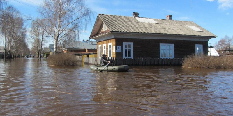
The idea of creating a fund arose from the need to solve the problem associated with the widespread damage that the flood causes annually to the ecology and economy of Kazakhstan. In April-May, as a result of snowmelt, millions of cubic meters of water flow into rivers and lakes. This leads to the fact that almost all water is sent to Russia, causing significant environmental and economic damage to the neighboring country.
Also, the cost of not having water in Kazakhstan also has its consequences. The drying up of the Aral Sea and other lakes on the territory of the republic leads to the destruction of biodiversity, the growth of diseases and the deterioration of conditions for agriculture.
It is from these reasons that the idea of creating a fund that will direct efforts to solve these problems arose. The Fund will work to prevent floods, promote the conservation of water resources and take measures to restore ecosystems. Moreover, the fund will support agriculture and conduct research in this area to find effective solutions.
The purpose of the fund is to minimize the damage caused by floods and prevent the lakes from drying up further. The creation of the fund will contribute to maintaining the ecological balance and economic development of Kazakhstan.

Reducing flood damage
Flooding is a natural disaster that poses a significant threat to human life and health, and also causes significant damage to agricultural land and property. To combat these problems, it is necessary to develop a comprehensive program to reduce damage from floods. The goal of this mission is to mitigate the effects of floods by implementing a range of measures that increase preparedness, prevent flood risk and increase resilience. This document sets out a strategic plan to achieve these goals.
Making the region more resilient to floods
Flooding poses a significant threat to human life, health and the environment. It can cause significant damage to infrastructure, agricultural land and private property, disrupting lives and economies. To mitigate these risks and build a more resilient region, we offer a comprehensive mission to make the region more resilient to floods. This mission involves a combination of preventive measures, early warning systems, community engagement and policy reforms to reduce flood damage while saving lives, agricultural land and property.
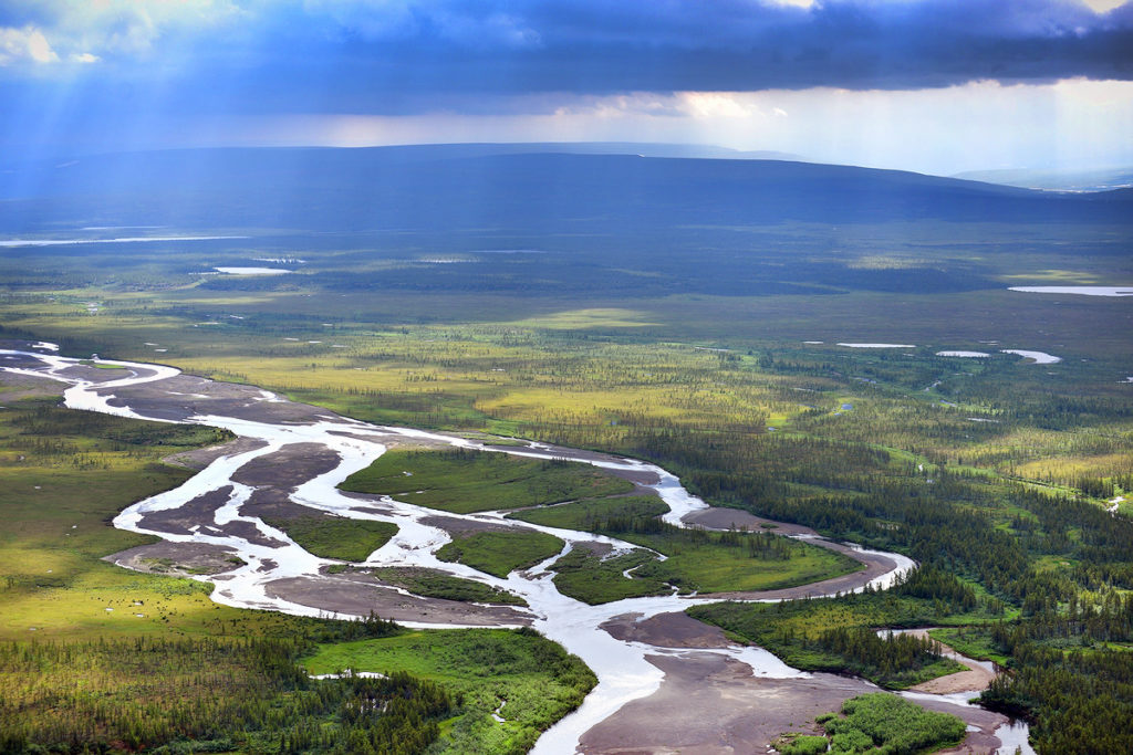
Conservation of the rich biodiversity of rivers
Rivers are not only vital sources of water, but also support diverse ecosystems and rich biodiversity. However, human activities and environmental issues pose a serious threat to riverine ecosystems and the species in which they live. The goal of this mission is to conserve the rich biodiversity of rivers through the implementation of strategies and initiatives to protect, restore and sustainably manage these precious ecosystems. The mission emphasizes long-term sustainability, collaboration and multi-stakeholder participation.
Short video about work for 2023
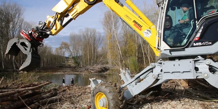
Strengthening the banks of the Ishim and Torgai rivers.
The Ishim and Torgai rivers are vital water sources and ecological systems for the region. However, severe erosion and degradation of their banks pose a significant threat to local communities, infrastructure and the environment. This plan aims to provide an integrated approach to strengthening the banks of these rivers, ensuring their long-term sustainability and reducing the risk of flooding and erosion. The plan includes both structural and non-structural measures to achieve these goals.
I. Evaluation and monitoring:
Conduct a detailed assessment of the current state of coastal erosion and identify risk zones along the Ishim and Torgai rivers.
Establish a continuous monitoring system to track changes in erosion patterns, water discharge, sediment deposition and land cover along river banks.
Use advanced satellite imagery, remote sensing technologies and GIS mapping to improve the accuracy and efficiency of your data collection.
II. Engineering interventions:
Implement bank protection measures such as geotextiles, gabion walls, linings and erosion control mats to stabilize and reinforce vulnerable areas.
Use bioengineering techniques, including planting native vegetation and creating coastal buffers, to improve coastal resilience and enhance environmental sustainability.
Strengthen existing river structures such as weirs, weirs and weirs to regulate flow and prevent excessive erosion.
III. Floodplain and wetland management:
Identify and protect floodplain areas that can absorb excess water during periods of peak flow, reducing pressure on river banks.
Restore and maintain natural wetlands along rivers that act as natural buffers against erosion and provide additional habitat for a variety of species.
Promote sustainable land management practices in floodplain areas, discouraging construction and deforestation that contribute to coastal erosion.
IV. Community Involvement and Education:
Carrying out information programs to inform the local population about the importance of the Ishim and Torgai rivers and the need to stabilize the banks.
Encourage public participation in river conservation initiatives and involve them in decision-making processes.
Provide training and capacity building opportunities on sustainable land management practices, erosion control techniques, and riverbank restoration methodologies.
V. Policy and management:
Develop and implement rules and policies to ensure responsible land use practices near river banks to prevent erosion.
Coordinate with relevant state authorities, water management authorities and environmental organizations to ensure the effective implementation of coastal protection measures.
Develop an integrated river basin management approach to oversee and coordinate activities related to river bank protection, flood prevention and ecosystem restoration.
VI. Long term sustainability:
Allocate sufficient funding and resources to continuously implement and sustain bank strengthening measures.
Establish a long-term monitoring and evaluation system to evaluate the effectiveness of implemented measures and adapt strategies as needed.
Promote research and innovation to explore new technologies, materials and methods for more sustainable and cost-effective bank stabilization solutions.
Conclusion:
Strengthening the banks of the Ishim and Torgai rivers is critical to maintaining ecological integrity, protecting the population and maintaining sustainable water resources. By applying a comprehensive plan that combines engineering interventions, floodplain management, public participation and political reforms, we can ensure the long-term sustainability and health of these rivers. This plan serves to zaint
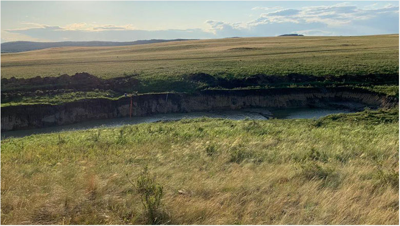
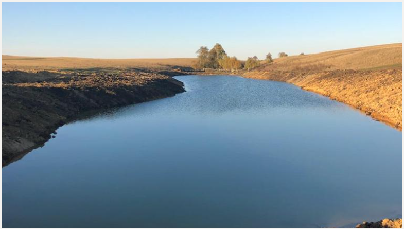
Construction of reservoirs in the river basin to collect flood waters.

Floods pose a significant threat to communities and infrastructure, causing extensive damage and loss of life. Constructing reservoirs in the river basin can effectively collect and manage floodwaters, reducing the impact downstream. This plan aims to provide a comprehensive approach to the construction of reservoirs, focusing on their optimal placement, capacity, and management for floodwater retention. The plan encompasses various aspects, including site selection, engineering considerations, environmental impact assessment, and long-term sustainability.
I. Preliminary Assessment:
1. Conduct a detailed analysis of historical flood patterns, including water flow, peak duration, and affected areas in the river basin.
2. Identify potential sites for reservoir construction in collaboration with hydrological experts, considering factors such as proximity to flood-prone areas, available land, and geological suitability.
3. Assess the potential water storage capacity required to effectively control floodwaters, considering the size and drainage area of the river basin.
II. Site Selection and Design:
1. Conduct a thorough feasibility study at each potential reservoir site to evaluate environmental impact, land use compatibility, and cost-effectiveness.
2. Consider topographical and geological aspects to ensure structural integrity and minimize seepage or leakage risks.
3. Ensure that necessary permits and regulatory approvals are obtained before proceeding with construction.
III. Reservoir Engineering:
1. Carry out detailed engineering designs, including dam and spillway structures, to ensure optimal floodwater storage and controlled release.
2. Incorporate advanced technologies, such as computer modeling and simulation, to predict water levels, manage inflows, and plan release schedules during floods.
3. Implement appropriate flood control measures, including gates, embankments, and emergency spillways, to manage surge volumes effectively.
IV. Environmental Considerations:
1. Conduct an environmental impact assessment (EIA) to identify potential ecological impacts and develop mitigation measures.
2. Implement measures to minimize the displacement of wildlife, protect biodiversity, and restore any ecosystems affected during the construction process.
3. Incorporate sustainable design principles, such as incorporating fish ladders or bypass channels, to maintain river connectivity and promote fish migration.
V. Stakeholder Engagement and Risk Communication:
1. Establish effective communication channels with local communities, governmental agencies, and other stakeholders to ensure their involvement, solicit feedback, and address concerns.
2. Educate and raise awareness among the public about the benefits and potential risks associated with reservoir construction, emphasizing flood mitigation and water storage advantages.
3. Develop emergency response plans and communicate evacuation procedures to ensure the safety of downstream communities during flood events.
VI. Operation and Maintenance:
1. Develop a comprehensive operation and maintenance plan for each reservoir, including regular inspections, sediment management, and infrastructure upkeep.
2. Train and establish a dedicated team responsible for the reservoir operations, monitoring, and coordination with relevant authorities.
3. Ensure sufficient funding and resources for ongoing maintenance, including periodic dredging and dam safety assessments.
VII. Integrated Water Management and Sustainability:
1. Integrate reservoir operation with overall water management strategies in the river basin, considering water supply, irrigation, and ecological needs.
2. Promote water conservation practices through public awareness campaigns and efficient irrigation techniques to maximize the benefits of reservoir storages.
3. Explore possibilities for renewable energy generation through hydropower utilizing reservoir releases, contributing to sustainable energy production.
VIII. Long-term Monitoring and Evaluation:
1. Establish a continuous monitoring system to assess the effectiveness of reservoirs in flood control, water storage, and downstream impact reduction.
2. Regularly review and update the flood risk assessment protocols and operation strategies based on the changing climatic patterns and land use dynamics.
3. Conduct periodic evaluations to ascertain the socio-economic benefits and environmental performance of the reservoirs.
Conclusion:
Building reservoirs in a river basin can significantly reduce flood risks, protect communities and provide sustainable water management solutions. By following a comprehensive plan that includes careful assessment, appropriate site selection, environmentally conscious design, stakeholder engagement and long-term monitoring, the construction and management of reservoirs can effectively capture flood water and contribute to the overall sustainability of the river basin. This plan serves as a roadmap for stakeholders to collaborate and implement flood control measures that will benefit both the environment and society as a whole.
Reduce flood damage, ensure safety and preserve land and property
Floods pose a significant threat to human life, health, agricultural land and property. To mitigate these risks, it is critical to develop a comprehensive plan to mitigate flood damage, keep communities safe, and preserve valuable assets. The plan outlines a range of measures, including structural and non-structural interventions, as well as effective monitoring and enforcement strategies.
I. Risk assessment and mapping:
Carry out a detailed assessment of the risk of flooded areas, taking into account historical data, topography, hydrological features and climate change forecasts.
Create accurate flood hazard maps highlighting high-risk areas, vulnerable infrastructure and valuable agricultural land for targeted action.
Use advanced remote sensing technologies, geographic information systems (GIS) and other tools to improve the accuracy of flood risk mapping.
II. Early warning systems:
Establish and maintain a reliable early warning system that integrates real-time weather forecast, hydrological data and remote sensing information.
Ensure that the system has reliable communication channels for the timely and accurate dissemination of flood warnings to the public, local authorities and emergency response agencies.
Conduct regular information programs to inform the public about flood preparedness, evacuation routes and safety measures to reduce the threat to life and health of people.
III. Infrastructure development:
Construct reservoirs and reservoirs at strategic locations in the river basin to collect excess flood water during periods of peak flow.
Design and construct the flood control channels, dams and embankments needed to redirect and contain flood waters while protecting vulnerable areas.
Collaborate with local municipalities, engineers and hydrology experts to identify suitable locations for infrastructure development.
IV. Land and water management:
Implement sustainable upstream land management practices such as afforestation, soil erosion control and reforestation to reduce runoff and slow flood water flow.
Encourage the adoption of responsible farming practices, including contour farming, terracing and the use of cover crops to minimize soil erosion and improve water infiltration.
Promoting the construction and maintenance of coastal buffer zones and wetlands to absorb excess water, reduce flood risks and improve ecosystem services.
V. Community participation and education:
Facilitate community participation by creating platforms for dialogue, encouraging public participation and incorporating local knowledge into flood risk management strategies.
Develop educational programs to raise community awareness of flood mitigation measures, safety protocols, and responsible land use practices.
Provide training and capacity building opportunities for local residents, farmers and community leaders to improve their understanding of flood risk and preparedness measures.
Policy and management:
Develop and enforce regulations that restrict construction in flood-prone areas, promoting responsible land-use planning and flood-resilient building codes.
Establish a coordinated structure involving government agencies, emergency response teams and community organizations to ensure effective flood management, response and recovery.
Regularly review and improve policies to adapt to changing climate conditions and take into account lessons learned from floods.
VII. Long term sustainability:
Provide adequate funding to implement and maintain flood mitigation and infrastructure improvements.
Continuously monitor and evaluate the effectiveness of measures through comprehensive post-flood assessments, community feedback and scientific research.
Implement adaptive management strategies, taking into account technological advances, climate change forecasts and evolving knowledge in flood risk management.
Conclusion:
By implementing this comprehensive plan to mitigate flood damage, keep communities safe, and preserve agricultural land and property, we can minimize the impact of floods on lives and infrastructure, protect valuable agricultural land, and increase overall resilience to future floods. Through cooperation among all stakeholders and continued commitment to implementing these measures, we can create a safer and more sustainable environment for both current and future generations.